Skip to content
  • Students & Alumni
    • Overview
    • Career Services
    • Alumni Relations
    • Student Support
    • Graduate Resource Library
  • News
  • Events
    • Events Calendar
    • Luskin Summit
    • Luskin Lecture Series
    • California Policy Briefing
    • Commencement
  • Students & Alumni
    • Overview
    • Career Services
    • Alumni Relations
    • Student Support
    • Graduate Resource Library
  • News
  • Events
    • Events Calendar
    • Luskin Summit
    • Luskin Lecture Series
    • California Policy Briefing
    • Commencement
Giving
  • Academics
    Departments
    • Public Policy
    • Real Estate Development
    • Social Welfare
    • Undergraduate Program
    • Urban Planning
    • Public Policy
    • Real Estate Development
    • Social Welfare
    • Undergraduate Program
    • Urban Planning
    Graduate Programs
    • Master of Public Policy (MPP)
    • Master of Real Estate Development (MRED)
    • Master of Social Welfare (MSW)
    • Master of Urban and Regional Planning (MURP)
    • PhD in Social Welfare
    • PhD in Urban Planning
    • Master of Public Policy (MPP)
    • Master of Real Estate Development (MRED)
    • Master of Social Welfare (MSW)
    • Master of Urban and Regional Planning (MURP)
    • PhD in Social Welfare
    • PhD in Urban Planning
    Undergraduate Programs
    • BA in Public Affairs
    • Minor in Urban and Regional Studies
    • Minor in Gerontology
    • Minor in Public Affairs
    • BA in Public Affairs
    • Minor in Urban and Regional Studies
    • Minor in Gerontology
    • Minor in Public Affairs
    Professional Certificates
    • Data Analytics Certificate
    • Data Analytics Certificate
  • Admissions
    Program Specific Admissions
    • Public Policy
    • Real Estate Development
    • Social Welfare
    • Urban Planning
    • Undergraduate Program
    • Public Policy
    • Real Estate Development
    • Social Welfare
    • Urban Planning
    • Undergraduate Program
  • Faculty
    Our Faculty
    • All Faculty
    • Public Policy
    • Real Estate Development
    • Social Welfare
    • Urban Planning
    • All Faculty
    • Public Policy
    • Real Estate Development
    • Social Welfare
    • Urban Planning
    Leadership
    • Our Dean
    • Board of Advisors
    • Faculty Executive Committee
    • Our Dean
    • Board of Advisors
    • Faculty Executive Committee
  • Research Centers
    • Agile Visual Analytics Lab (AVAL):

      Uses data visualization to improve decision-making for family and child services.

    • Berggruen Governance Index

      Evaluates the quality of political governance and democracy worldwide.

    • Center for Neighborhood Knowledge (CNK)

      Specializes in spatial analysis of socioeconomic disparities in neighborhoods.

    • Center for Policy Research on Aging (CPRA)

      Explores the societal and policy implications of an aging population.

    • Agile Visual Analytics Lab (AVAL):

      Uses data visualization to improve decision-making for family and child services.

    • Berggruen Governance Index

      Evaluates the quality of political governance and democracy worldwide.

    • Center for Neighborhood Knowledge (CNK)

      Specializes in spatial analysis of socioeconomic disparities in neighborhoods.

    • Center for Policy Research on Aging (CPRA)

      Explores the societal and policy implications of an aging population.

    • Institute of Transportation Studies (ITS)

      A national leader in transportation policy and mobility research.

    • Institute on Inequality and Democracy

      Advances scholarship that confronts threats to democracy in America and around the world.

    • Latin American Cities Initiative

      Connects urban planning and policy networks across the Americas.

    • Latino Policy & Politics Institute (LPPI)

      Addresses policy challenges facing Latinos and communities of color.

    • Institute of Transportation Studies (ITS)

      A national leader in transportation policy and mobility research.

    • Institute on Inequality and Democracy

      Advances scholarship that confronts threats to democracy in America and around the world.

    • Latin American Cities Initiative

      Connects urban planning and policy networks across the Americas.

    • Latino Policy & Politics Institute (LPPI)

      Addresses policy challenges facing Latinos and communities of color.

    • Lewis Center for Regional Policy Studies

      Studying housing affordability and transportation equity in the L.A. region.

    • Los Angeles Education Research Institute (LAERI)

      Collaborates with schools to improve educational outcomes for L.A. students.

    • Luskin Center for Innovation (LCI)

      Focuses on environmental policy, clean energy, and climate justice.

    • UCLA Voting Rights Project

      The flagship project for voting rights litigation and policy research.

    • Lewis Center for Regional Policy Studies

      Studying housing affordability and transportation equity in the L.A. region.

    • Los Angeles Education Research Institute (LAERI)

      Collaborates with schools to improve educational outcomes for L.A. students.

    • Luskin Center for Innovation (LCI)

      Focuses on environmental policy, clean energy, and climate justice.

    • UCLA Voting Rights Project

      The flagship project for voting rights litigation and policy research.

    All Research Centers
  • Outcomes
Home / Narrower Streets in New Developments Could Help Amid Housing Crisis

Narrower Streets in New Developments Could Help Amid Housing Crisis

New research by Adam Millard-Ball of UCLA Urban Planning considers the schools, parks and other infrastructure that go unbuilt because Americans prefer wide streets

Posted in

  • Complete Streets, Development and Housing, Environment, For Faculty, For Policymakers, For Students, For Undergraduates, Public Policy, Public Policy News, Research Projects, School of Public Affairs, Transportation, Urban Planning

Published on

  • July 7, 2021
  • development, housing, land use, planning, streets, traffic, Transportation, zoning

Share this Article

By Clark Merrefield
The Journalist’s Resource

With cities and suburbs across the United States facing well-documented affordable housing shortages, researchers for years have studied how government planning standards affect housing costs.

Those studies often examine how planning and zoning decisions affect traffic noise, whether neighborhood amenities can be reached by foot and other factors that can make a home more or less valuable.

A new paper expands this body of research by considering the housing, schools, parks and other infrastructure that go unbuilt in favor of wide streets.

The U.S. has some of the widest streets in the world. In 20 of the most populous counties, the median residential street plus sidewalks is 50 feet wide, with the dollar value of land used for streets sometimes stretching into six figures, according to the research in the Journal of the American Planning Association.
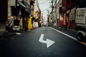
Wide streets
A narrow street in Shibuya City, Tokyo. Photo by Tim Foster / Unsplash

Wide streets are less common in some other countries. Certain streets in Japan, for example, are much narrower. Developments in Tokyo since 1990 have average street widths of 16 feet, noted Adam Millard-Ball, an associate professor of urban planning at the UCLA Luskin School of Public Affairs and author of the new paper.

“One of the best ways to alleviate the housing crisis is to build more housing,” he said. “To the extent that narrower streets allow developers to build more housing, that will address the No. 1 issue with housing right now.”

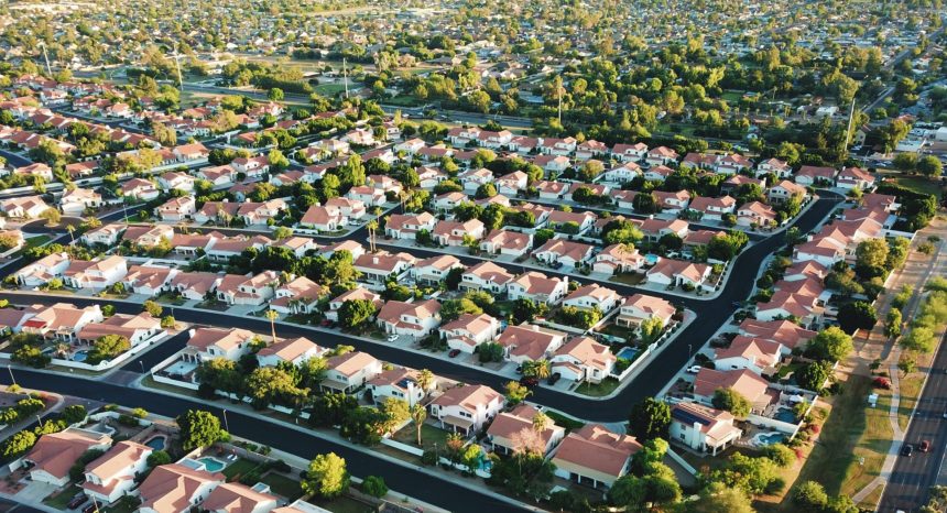
The median residential street in Arizona’s Maricopa County, which includes Phoenix, is 50 feet wide, according to Millard-Ball’s sample of counties.

The median width of a residential street in Middlesex County, Massachusetts, which includes Cambridge, is 40 feet — the narrowest of the group.

The widest streets in the sample are in Cook County, Illinois, which includes Chicago. There, the median residential street is nearly 65 feet wide.

The 50-foot standard

For urban planners, a street is called a right of way. The paved section is the roadway.

A right of way includes the roadway as well as sidewalks, if any, along with space for drainage, utility poles and other public infrastructure. It’s the land usually owned by a city or county that the public has the right to use and make its way through by car, bicycle, foot or other mode. Neighbors waving hello across the sidewalk’s edge of their properties are waving across the right of way.

The median 50-foot right of way Millard-Ball documents stems from nearly a century of history in U.S. planning. After the home mortgage system collapsed during the Great Depression, the federal government stepped in and established the Federal Housing Administration in 1934.

The agency’s mortgage insurance and financial assistance for homebuyers represented “the most ambitious suburbanization plan in United States history,” wrote Michael Southworth and Eran Ben-Joseph in a 1995 Journal of the American Planning Association article that reviews the historical rise of U.S. suburbs.

To protect the government’s unprecedented investment in home ownership, mostly for white Americans, developers had to have detailed plans approved by the agency. The agency encouraged cul-de-sacs for new developments and favored plans that discouraged through traffic.

“Moreover, the FHA, unlike other planning agencies, was largely run by representatives of real estate and banking, so developers felt that its intervention protected their interests,” Southworth and Ben-Joseph wrote.

If developers wanted to build homes that would benefit from federal financial backing, rights of way had to be at least 50 feet wide, Millard-Ball explained in his new paper, “The Width and Value of Residential Streets.”

Six-figure values

To understand the value of land used for streets, Millard-Ball drew on research from the Federal Housing Finance Agency that estimates the value of quarter-acre lots zoned for single-family homes across the country. The value of the land used for streets can be substantial in places where low population density and high housing costs converge.

Santa Clara County, California, which includes San Jose, has the most valuable streets in the sample at $146,000 per tax parcel. That’s roughly 40% of the median price of an existing single-family home sold in the U.S. in April 2021, according to data from the National Association of Realtors.

“One of the best ways to alleviate the housing crisis is to build more housing. To the extent that narrower streets allow developers to build more housing, that will address the No. 1 issue with housing right now.”

— Adam Millard-Ball, UCLA Luskin

New York City, by contrast, has high housing costs but also high density — large apartment buildings are common. Tens of thousands of people live within each square mile. The land beneath streets in Queens, for example, is worth $36,000 per parcel.

At the other end of the value spectrum, streets are worth $7,000 per parcel in Bexar County, Texas, which includes San Antonio. But land values and street widths can vary greatly within counties.

Terra Vista, a small street in a subdivision 25 miles north of San Antonio, is 52 feet wide and has a land value of $43,288 per parcel. All the land under residential streets in Millard-Ball’s 20 counties is worth nearly $1 trillion in total.

Millard-Ball noted that street land value estimates per parcel are likely low for high-cost, dense cities, which often zone for multifamily buildings over single-family homes.

For example, an Italian specialty food store in the Mission District of San Francisco sold its parking lot for $3 million in 2018 — roughly $36 million per acre, by Millard-Ball’s calculation — to make way for a five-story, 18-unit building, according to the news site Mission Local.

Click to explore the value of land used for streets in 20 of the largest U.S. counties.

Most U.S. counties regulate how and where new housing and business developments are built, according to the National Association of Counties, a nonprofit organization that represents U.S. county governments.

Many large cities do the same.

It would be overly costly for cities and counties to change the width of existing streets, particularly with local governments facing budget shortfalls during the pandemic.

Still, the estimates in the new paper can be instructive for planning officials in places like Bexar, one of the fastest growing counties in the U.S., as they permit developments to accommodate new and current residents.

“The values are an indication that cities should be making it easier to use streets for something other than roadways and parking,” Millard-Ball said. “A good analogy is that during COVID, one use of streets has been for outdoor dining. It’s recognition that this land is more valuable to the community if we can use it for people to get together and eat in a safer environment outdoors, than as a parking space or travel lane for cars.”

He continued: “The point is that desolate asphalt is doing nobody any good — not the city, not property owners, not anyone. Cities are often keen to widen the right of way with new developments. Say you want to develop a new apartment building. Often, the city will say, ‘Sure, but you have to give up some land so we can add a turn lane, or widen the sidewalk.’ If cities can widen the right of way, why can’t they narrow it in exchange for improvements that will benefit the public?”

Indeed, when a new residential building goes up, cities commonly require developers to widen streets, according to a 2017 paper in the Journal of Transport and Land Use by Michael Manville, another UCLA Luskin urban planner.

In the paper, Manville looked at how the requirement played out in Los Angeles from 2002 to 2012. He found the city’s predictions of increased traffic with the arrival of new buildings were often wrong, and “the standards the law is based on are in some ways unverifiable. Thus the law likely does little to reduce congestion and probably impedes housing development.”

Flexible design

City and county planning standards vary and change, but the federal 50-foot standard still often dominates residential street design. Still, it’s not always true that counties with more land to expand, like those in Texas, have wider streets. Dallas County, for example, specifies that new residential streets in subdivisions be at least 50 feet wide. The median width of residential streets there is exactly 50 feet, Millard-Ball finds.

Surveyor's chain
A surveyor’s chain owned by John Johnson, appointed Surveyor General of Vermont in 1813. Photo by John Johnson Allen / National Museum of American History

Residential streets in Chicago, meanwhile, are typically 66 feet wide, according to city design standards. That roughly matches the length of the typical surveyor’s chain as the city grew throughout the 1800s and early 1900s. The surveyor’s chain was a tool made up of interlocking metal bars that land surveyors used to measure and mark the shapes of streets to be built.

Uniformity in street design made sense as the nation was expanding and infrastructure technologies were less advanced. But the takeaway for Millard-Ball is that maintaining rigidity in street design means fewer amenities and, potentially, less housing.

He wonders, for example, whether more streets could be built with parking cutouts only where there are no private driveways — providing a unique residential landscape alongside opportunities to use more of the built environment for activities other than driving.

“That would make construction drawings more complex,” Millard-Ball said. “The tradeoff is visual interest — and saving a lot of valuable land.”

The prospect of narrower streets raises the question of whether emergency vehicles would be able to pass, though some planners, and at least one report from the U.S. Department of Transportation, suggest smaller emergency vehicles could be an answer.

This article first appeared on The Journalist’s Resource and is republished here with slight revisions for local style under a Creative Commons license.

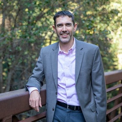
Faculty Mentioned in this Article
Millard-Ball headshot square (1)

Adam Millard-Ball

Professor of Urban Planning

Adam Millard-Ball is Professor of Urban Planning at the UCLA Luskin School of Public Affairs and director of the UCLA...

Related Articles

Aerial view of a parking lot with a row of cars and another row of empty parking spaces.

Rethinking Parking Lots to Combat Urban Heat and Flooding

May 26, 2026
Luskin in the News
Cities are testing cooler, permeable parking lot designs to reduce urban heat, flooding and excess paved...
Read More
4 men biking cycling in a line on a street in a city

Global Study Reveals Best Cities for Walking and Cycling

November 19, 2025
Luskin in the News
Lead author Adam Millard-Ball of UCLA emphasizes that good infrastructure drives walking and biking in cities...
Read More
Cyclists on bike path.

‘Active travel’ study identifies pathways for designing walking- and cycling-friendly cities

June 11, 2025
Luskin's Latest Blog
City-level policies reduce global emissions by 6% and create about $435 billion in health benefits....
Read More
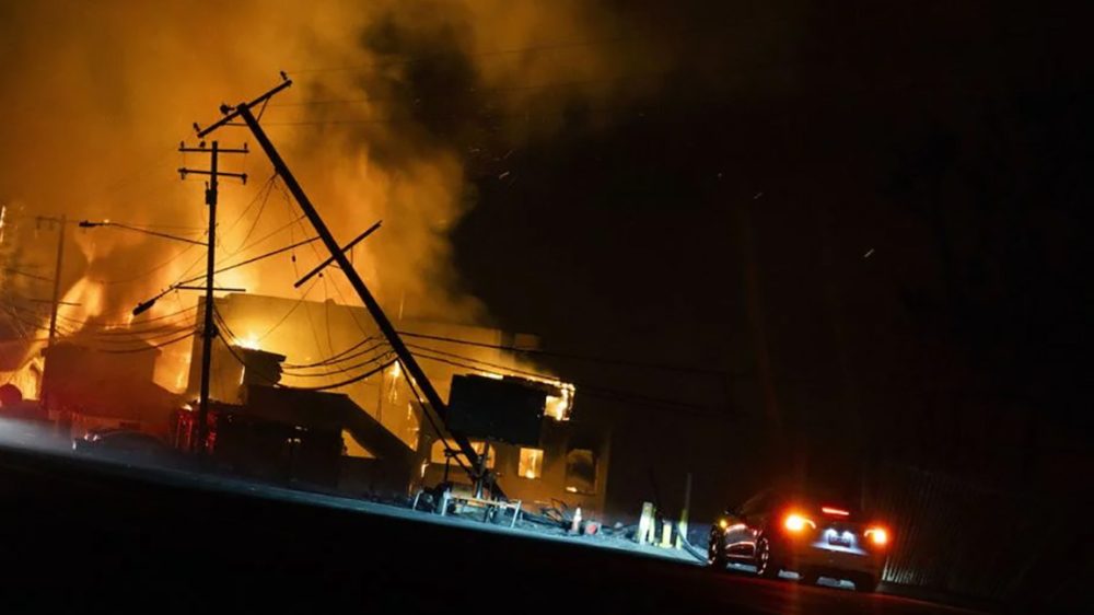
Image of burning building

Millard-Ball on Street Design and L.A. Wildfires

June 3, 2025
Luskin in the News
Current street designs are recipe for disaster during emergencies, says UCLA planning expert....
Read More
Image of Robert Hampshire and Ann E. Carlson.

Former U.S. Department of Transportation Assistant Secretary for Research and Technology Delivers Luskin Lecture

May 30, 2025
Digital Technologies
Robert Hampshire, former Assistant Secretary for Research and Technology at the United States Department of Transportation,...
Read More
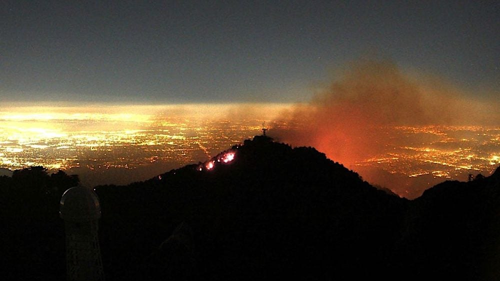
flames and smoke above lights of Los Angeles

UCLA ITS Funds Research on Vulnerable Communities, L.A. Fire Response

February 6, 2025
For Faculty
Five projects will explore transportation challenges and community engagement in disaster recovery....
Read More
PPlfire16x9

Millard-Ball on Fire, Sprawl and Car Dependency

January 21, 2025
Luskin in the News
Neighborhoods that struggled to safely evacuate are among the least connected in L.A. County, the UCLA...
Read More
driverlssTxi1

Millard-Ball on Realities of Autonomous Taxis

October 24, 2024
Luskin in the News
Robotaxis may not yet spell the end of private car ownership....
Read More
Man in glasses at podium with blue and black backdrop|

Leadership Transition at UCLA Institute of Transportation Studies

July 2, 2024
For Faculty
After more than two decades guiding research center's growth, Brian Taylor hands reins to Adam Millard-Ball....
Read More
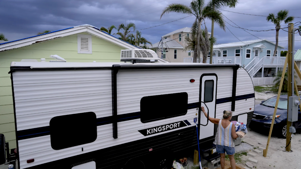
woman entering RV under threatening skies

RV Life as an Affordable Housing Option

June 11, 2024
Luskin in the News
“Some people like the nomadic existence, but for many it’s the lesser of two evils,” UCLA...
Read More
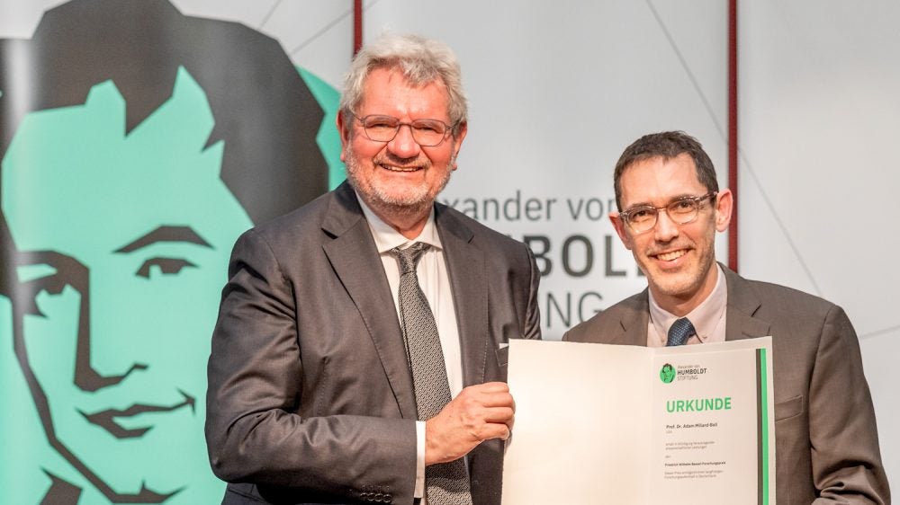
Two men holding paper folder holding award statement

Millard-Ball Receives Friedrich Wilhelm Bessel Research Award

April 18, 2024
Luskin's Latest Blog
The professor of urban planning is conducting research in Berlin with support from the award, which...
Read More
|

Millard-Ball on Who Deserves Carbon Credits

June 22, 2023
Luskin in the News
California-based company seeks to retain credits for its vehicle chargers....
Read More
Learn more about UCLA Luskin

Find contact information and get answers to your questions.

Contact Us

Public Affairs Building
337 Charles E. Young Drive East
Los Angeles, California 90095

Linkedin Youtube Instagram Facebook X-twitter
Campus Resources
  • Map, Directions, Parking
  • Directory
  • Academic Calendar
  • Careers
  • Map, Directions, Parking
  • Directory
  • Academic Calendar
  • Careers
School Resources
  • About
  • Our Dean
  • Administration
  • Board of Advisors
  • Contact Us
  • Visit Us
  • About
  • Our Dean
  • Administration
  • Board of Advisors
  • Contact Us
  • Visit Us
© 2026 Regents of the University of California
  • Emergency
  • Accessibilty
  • Privacy & Terms of Use
  • Emergency
  • Accessibilty
  • Privacy & Terms of Use
Facebook Instagram Linkedin X-twitter Youtube Threads
Academics
Departments
  • Public Policy
  • Real Estate Development
  • Social Welfare
  • Undergraduate Program
  • Urban Planning
  • Public Policy
  • Real Estate Development
  • Social Welfare
  • Undergraduate Program
  • Urban Planning
Graduate Programs
  • Master of Public Policy (MPP)
  • Master of Real Estate Development (MRED)
  • Master of Social Welfare (MSW)
  • Master of Urban and Regional Planning (MURP)
  • PhD in Social Welfare
  • PhD in Urban Planning
  • Master of Public Policy (MPP)
  • Master of Real Estate Development (MRED)
  • Master of Social Welfare (MSW)
  • Master of Urban and Regional Planning (MURP)
  • PhD in Social Welfare
  • PhD in Urban Planning
Undergraduate Programs
  • BA in Public Affairs
  • Minor in Urban and Regional Studies
  • Minor in Gerontology
  • Minor in Public Affairs
  • BA in Public Affairs
  • Minor in Urban and Regional Studies
  • Minor in Gerontology
  • Minor in Public Affairs
Professional Certificates
  • Data Analytics Certificate
  • Data Analytics Certificate
Admissions
Program Specific Admissions
  • Public Policy
  • Real Estate Development
  • Social Welfare
  • Urban Planning
  • Undergraduate Program
  • Public Policy
  • Real Estate Development
  • Social Welfare
  • Urban Planning
  • Undergraduate Program
Faculty
Our Faculty
  • All Faculty
  • Public Policy
  • Real Estate Development
  • Social Welfare
  • Urban Planning
  • All Faculty
  • Public Policy
  • Real Estate Development
  • Social Welfare
  • Urban Planning
Leadership
  • Our Dean
  • Board of Advisors
  • Faculty Executive Committee
  • Our Dean
  • Board of Advisors
  • Faculty Executive Committee
Research Centers
  • Agile Visual Analytics Lab (AVAL):

    Uses data visualization to improve decision-making for family and child services.

  • Berggruen Governance Index

    Evaluates the quality of political governance and democracy worldwide.

  • Center for Neighborhood Knowledge (CNK)

    Specializes in spatial analysis of socioeconomic disparities in neighborhoods.

  • Center for Policy Research on Aging (CPRA)

    Explores the societal and policy implications of an aging population.

  • Agile Visual Analytics Lab (AVAL):

    Uses data visualization to improve decision-making for family and child services.

  • Berggruen Governance Index

    Evaluates the quality of political governance and democracy worldwide.

  • Center for Neighborhood Knowledge (CNK)

    Specializes in spatial analysis of socioeconomic disparities in neighborhoods.

  • Center for Policy Research on Aging (CPRA)

    Explores the societal and policy implications of an aging population.

  • Institute of Transportation Studies (ITS)

    A national leader in transportation policy and mobility research.

  • Institute on Inequality and Democracy

    Advances scholarship that confronts threats to democracy in America and around the world.

  • Latin American Cities Initiative

    Connects urban planning and policy networks across the Americas.

  • Latino Policy & Politics Institute (LPPI)

    Addresses policy challenges facing Latinos and communities of color.

  • Institute of Transportation Studies (ITS)

    A national leader in transportation policy and mobility research.

  • Institute on Inequality and Democracy

    Advances scholarship that confronts threats to democracy in America and around the world.

  • Latin American Cities Initiative

    Connects urban planning and policy networks across the Americas.

  • Latino Policy & Politics Institute (LPPI)

    Addresses policy challenges facing Latinos and communities of color.

  • Lewis Center for Regional Policy Studies

    Studying housing affordability and transportation equity in the L.A. region.

  • Los Angeles Education Research Institute (LAERI)

    Collaborates with schools to improve educational outcomes for L.A. students.

  • Luskin Center for Innovation (LCI)

    Focuses on environmental policy, clean energy, and climate justice.

  • UCLA Voting Rights Project

    The flagship project for voting rights litigation and policy research.

  • Lewis Center for Regional Policy Studies

    Studying housing affordability and transportation equity in the L.A. region.

  • Los Angeles Education Research Institute (LAERI)

    Collaborates with schools to improve educational outcomes for L.A. students.

  • Luskin Center for Innovation (LCI)

    Focuses on environmental policy, clean energy, and climate justice.

  • UCLA Voting Rights Project

    The flagship project for voting rights litigation and policy research.

All Research Centers
Outcomes
Common Search Terms

Results will show as you type.