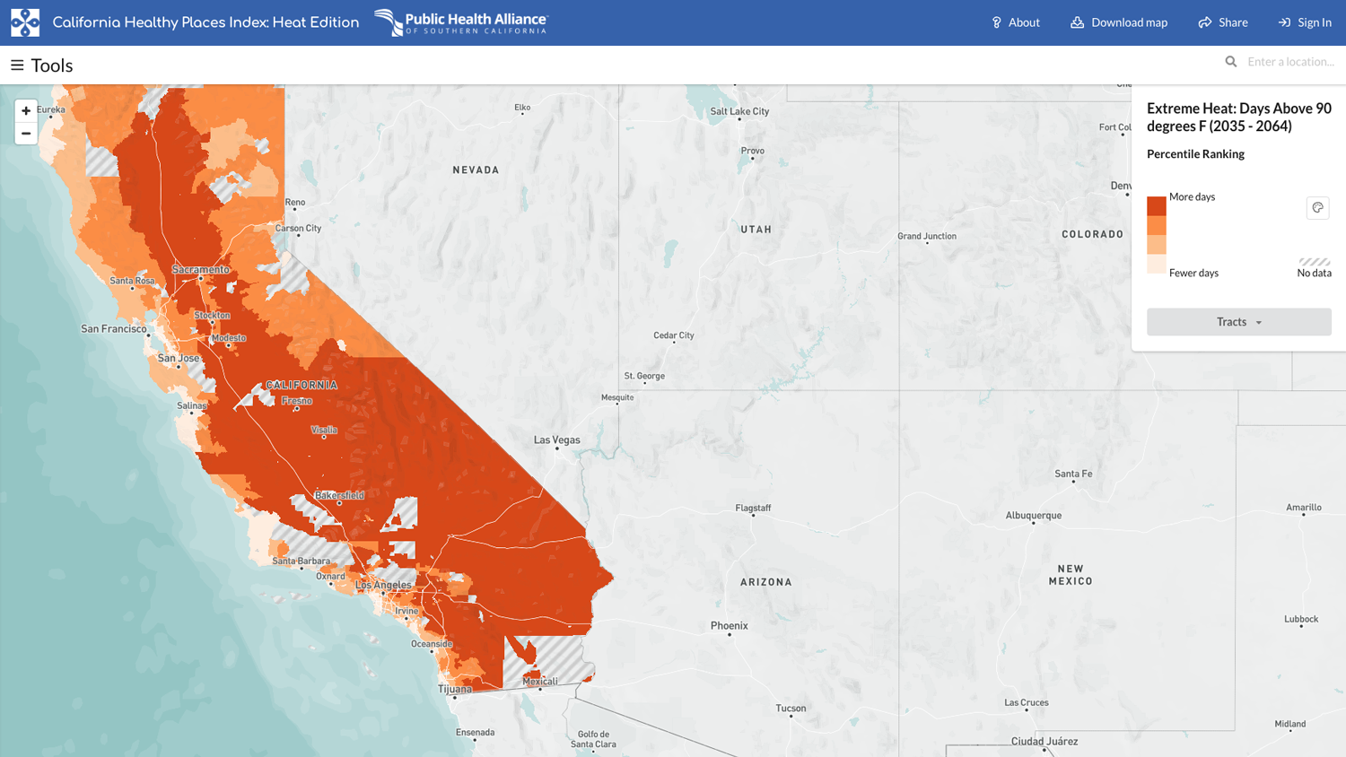
New Online Mapping Tool Helps California Prepare for Extreme Heat
As summer kicks off and California braces for more record-breaking temperatures, a new tool co-developed by UCLA researchers will help government officials, school administrators and communities visualize the neighborhoods most in danger from extreme heat. Low-income residents and communities of color are impacted most by hot weather, which is the deadliest effect of climate change in California. “Heat is an equity issue. Neighborhood by neighborhood, we’re going to be experiencing heat differently,” said Colleen Callahan, co-executive director of the UCLA Luskin Center for Innovation. “That’s why it’s important to identify where protections are most needed, and where they’ll have the biggest impact.” The online mapping tool developed by UCLA and the Public Health Alliance of Southern California allows users to find information about temperature extremes, explore vulnerable populations, understand community health situations and seek out state resources such as air conditioners for low-income households. Researchers created the tool with a variety of audiences in mind. For instance, data at the school district level can help educators understand how their risk compares to nearby districts. They can also identify funding programs to weatherize classrooms and playgrounds. Other users, like state agencies, nonprofit organizations, and local and tribal governments, can use the tool to identify where to target investments. At the household level, residents can find programs to make their homes more energy efficient, help pay for energy costs or install rooftop solar panels to provide cheaper electricity. The California Strategic Growth Council’s Climate Change Research Program provided funding.


Leave a Reply
Want to join the discussion?Feel free to contribute!