• COVID-19 FAQ
  • Public Policy
  • Social Welfare
  • Urban Planning
  • Undergraduate Program
  • Contact
  • Events Calendar
  • Give Now
UCLA Luskin
  • About
    • Our Dean
    • Board of Advisors
    • Open Positions
    • Contact Us
    • Visit Us
    • Diversity, Disparities and Difference
    • Communications
      • UCLA Luskin in the News
      • Luskin Forum Online
  • Departments | BA in Public Affairs
    • Public Policy
    • Social Welfare
    • Undergraduate Program
  • Apply
    • Master of Public Policy
    • Master of Social Welfare
    • Master of Urban and Regional Planning
      • Double Degree With Sciences Po
    • PhD in Social Welfare
    • PhD in Urban Planning
    • Undergraduate Programs
  • Faculty
    • Public Policy
    • Social Welfare
    • Urban Planning
  • Student Affairs & Alumni
    • Career Services
    • Student Support
    • Graduate Resource Library
    • Alumni Relations
  • Support
  • Programs
    • Research Centers & Affiliated Research
    • CalSWEC Public Child Welfare Program
    • Global Public Affairs (GPA)
    • Data Analytics Certificate
    • Luskin Lecture Series
    • Luskin Summit
    • Social Welfare at 75
  • Administration
    • Graduate Resource Library
    • Academic Personnel
    • Financial Services
    • Emergency Safety
    • Events Office
      • Events Calendar
      • Reserve a Room
    • Human Resources
    • For New Staff and Faculty
    • Information Technology
  • Search
  • Menu Menu

Archive for category: Complete Streets

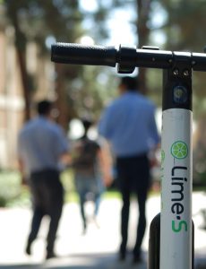
Narrower Streets in New Developments Could Help Amid Housing Crisis New research by Adam Millard-Ball of UCLA Urban Planning considers the schools, parks and other infrastructure that go unbuilt because Americans prefer wide streets

July 7, 2021/0 Comments/in Complete Streets, Development and Housing, Environment, For Faculty, For Policymakers, For Students, For Undergraduates, Public Policy, Public Policy News, Research Projects, School of Public Affairs, Transportation, Urban Planning Adam Millard-Ball /by webteam

By Clark Merrefield
The Journalist’s Resource

With cities and suburbs across the United States facing well-documented affordable housing shortages, researchers for years have studied how government planning standards affect housing costs.

Those studies often examine how planning and zoning decisions affect traffic noise, whether neighborhood amenities can be reached by foot and other factors that can make a home more or less valuable.

A new paper expands this body of research by considering the housing, schools, parks and other infrastructure that go unbuilt in favor of wide streets.

The U.S. has some of the widest streets in the world. In 20 of the most populous counties, the median residential street plus sidewalks is 50 feet wide, with the dollar value of land used for streets sometimes stretching into six figures, according to the research in the Journal of the American Planning Association.

Wide streets
A narrow street in Shibuya City, Tokyo. Photo by Tim Foster / Unsplash

Wide streets are less common in some other countries. Certain streets in Japan, for example, are much narrower. Developments in Tokyo since 1990 have average street widths of 16 feet, noted Adam Millard-Ball, an associate professor of urban planning at the UCLA Luskin School of Public Affairs and author of the new paper.

“One of the best ways to alleviate the housing crisis is to build more housing,” he said. “To the extent that narrower streets allow developers to build more housing, that will address the No. 1 issue with housing right now.”

The median residential street in Arizona’s Maricopa County, which includes Phoenix, is 50 feet wide, according to Millard-Ball’s sample of counties.

The median width of a residential street in Middlesex County, Massachusetts, which includes Cambridge, is 40 feet — the narrowest of the group.

The widest streets in the sample are in Cook County, Illinois, which includes Chicago. There, the median residential street is nearly 65 feet wide.

The 50-foot standard

For urban planners, a street is called a right of way. The paved section is the roadway.

A right of way includes the roadway as well as sidewalks, if any, along with space for drainage, utility poles and other public infrastructure. It’s the land usually owned by a city or county that the public has the right to use and make its way through by car, bicycle, foot or other mode. Neighbors waving hello across the sidewalk’s edge of their properties are waving across the right of way.

The median 50-foot right of way Millard-Ball documents stems from nearly a century of history in U.S. planning. After the home mortgage system collapsed during the Great Depression, the federal government stepped in and established the Federal Housing Administration in 1934.

The agency’s mortgage insurance and financial assistance for homebuyers represented “the most ambitious suburbanization plan in United States history,” wrote Michael Southworth and Eran Ben-Joseph in a 1995 Journal of the American Planning Association article that reviews the historical rise of U.S. suburbs.

To protect the government’s unprecedented investment in home ownership, mostly for white Americans, developers had to have detailed plans approved by the agency. The agency encouraged cul-de-sacs for new developments and favored plans that discouraged through traffic.

“Moreover, the FHA, unlike other planning agencies, was largely run by representatives of real estate and banking, so developers felt that its intervention protected their interests,” Southworth and Ben-Joseph wrote.

If developers wanted to build homes that would benefit from federal financial backing, rights of way had to be at least 50 feet wide, Millard-Ball explained in his new paper, “The Width and Value of Residential Streets.”

Six-figure values

To understand the value of land used for streets, Millard-Ball drew on research from the Federal Housing Finance Agency that estimates the value of quarter-acre lots zoned for single-family homes across the country. The value of the land used for streets can be substantial in places where low population density and high housing costs converge.

Santa Clara County, California, which includes San Jose, has the most valuable streets in the sample at $146,000 per tax parcel. That’s roughly 40% of the median price of an existing single-family home sold in the U.S. in April 2021, according to data from the National Association of Realtors.

“One of the best ways to alleviate the housing crisis is to build more housing. To the extent that narrower streets allow developers to build more housing, that will address the No. 1 issue with housing right now.”

— Adam Millard-Ball, UCLA Luskin

New York City, by contrast, has high housing costs but also high density — large apartment buildings are common. Tens of thousands of people live within each square mile. The land beneath streets in Queens, for example, is worth $36,000 per parcel.

At the other end of the value spectrum, streets are worth $7,000 per parcel in Bexar County, Texas, which includes San Antonio. But land values and street widths can vary greatly within counties.

Terra Vista, a small street in a subdivision 25 miles north of San Antonio, is 52 feet wide and has a land value of $43,288 per parcel. All the land under residential streets in Millard-Ball’s 20 counties is worth nearly $1 trillion in total.

Millard-Ball noted that street land value estimates per parcel are likely low for high-cost, dense cities, which often zone for multifamily buildings over single-family homes.

For example, an Italian specialty food store in the Mission District of San Francisco sold its parking lot for $3 million in 2018 — roughly $36 million per acre, by Millard-Ball’s calculation — to make way for a five-story, 18-unit building, according to the news site Mission Local.

Click to explore the value of land used for streets in 20 of the largest U.S. counties.

Most U.S. counties regulate how and where new housing and business developments are built, according to the National Association of Counties, a nonprofit organization that represents U.S. county governments.

Many large cities do the same.

It would be overly costly for cities and counties to change the width of existing streets, particularly with local governments facing budget shortfalls during the pandemic.

Still, the estimates in the new paper can be instructive for planning officials in places like Bexar, one of the fastest growing counties in the U.S., as they permit developments to accommodate new and current residents.

“The values are an indication that cities should be making it easier to use streets for something other than roadways and parking,” Millard-Ball said. “A good analogy is that during COVID, one use of streets has been for outdoor dining. It’s recognition that this land is more valuable to the community if we can use it for people to get together and eat in a safer environment outdoors, than as a parking space or travel lane for cars.”

He continued: “The point is that desolate asphalt is doing nobody any good — not the city, not property owners, not anyone. Cities are often keen to widen the right of way with new developments. Say you want to develop a new apartment building. Often, the city will say, ‘Sure, but you have to give up some land so we can add a turn lane, or widen the sidewalk.’ If cities can widen the right of way, why can’t they narrow it in exchange for improvements that will benefit the public?”

Indeed, when a new residential building goes up, cities commonly require developers to widen streets, according to a 2017 paper in the Journal of Transport and Land Use by Michael Manville, another UCLA Luskin urban planner.

In the paper, Manville looked at how the requirement played out in Los Angeles from 2002 to 2012. He found the city’s predictions of increased traffic with the arrival of new buildings were often wrong, and “the standards the law is based on are in some ways unverifiable. Thus the law likely does little to reduce congestion and probably impedes housing development.”

Flexible design

City and county planning standards vary and change, but the federal 50-foot standard still often dominates residential street design. Still, it’s not always true that counties with more land to expand, like those in Texas, have wider streets. Dallas County, for example, specifies that new residential streets in subdivisions be at least 50 feet wide. The median width of residential streets there is exactly 50 feet, Millard-Ball finds.

Surveyor's chain
A surveyor’s chain owned by John Johnson, appointed Surveyor General of Vermont in 1813. Photo by John Johnson Allen / National Museum of American History

Residential streets in Chicago, meanwhile, are typically 66 feet wide, according to city design standards. That roughly matches the length of the typical surveyor’s chain as the city grew throughout the 1800s and early 1900s. The surveyor’s chain was a tool made up of interlocking metal bars that land surveyors used to measure and mark the shapes of streets to be built.

Uniformity in street design made sense as the nation was expanding and infrastructure technologies were less advanced. But the takeaway for Millard-Ball is that maintaining rigidity in street design means fewer amenities and, potentially, less housing.

He wonders, for example, whether more streets could be built with parking cutouts only where there are no private driveways — providing a unique residential landscape alongside opportunities to use more of the built environment for activities other than driving.

“That would make construction drawings more complex,” Millard-Ball said. “The tradeoff is visual interest — and saving a lot of valuable land.”

The prospect of narrower streets raises the question of whether emergency vehicles would be able to pass, though some planners, and at least one report from the U.S. Department of Transportation, suggest smaller emergency vehicles could be an answer.

This article first appeared on The Journalist’s Resource and is republished here with slight revisions for local style under a Creative Commons license.

An Outdoor Oasis for Angelenos in Their Golden Years A Westlake park designed for older adults brings UCLA Luskin research to life

December 5, 2019/0 Comments/in Complete Streets, For Faculty, For Policymakers, For Students, For Undergraduates, Public Policy, Research Projects, School of Public Affairs, Social Welfare, Urban Planning Anastasia Loukaitou-Sideris, Lené Levy- Storms, Madeline Brozen /by Mary Braswell

By Mary Braswell

At Los Angeles’ new Golden Age Park, garden beds are raised far above ground so that visitors can tend to flowers and vegetables without stooping down.

Lawns, pathways and exercise areas are laid out on one seamless plane — a stumble-proof surface for those who move about with canes, walkers and wheelchairs.

Once a vacant lot, this tranquil green space was designed with older adults in mind — the culmination of research spearheaded by a team from the UCLA Luskin School of Public Affairs.

“It’s a little oasis in the city, less than a third of an acre,” said Urban Planning Professor Anastasia Loukaitou-Sideris, who launched the study of senior-friendly open spaces that would eventually evolve into a blueprint for Golden Age Park.

Expanding knowledge to bring real change to people’s lives is a core part of UCLA Luskin’s mission. But researchers rarely see their ideas brought to life so vividly, Loukaitou-Sideris’ team agreed.

At Golden Age Park, visitors can stroll along circular walkways, build strength and balance on low-impact exercise machines, practice their gardening skills, or simply rest in areas designed for socializing or solitude. Shade trees, roses and purple sage create a pocket of nature on a street lined with apartment buildings.

The park’s architects relied on a toolkit called “Placemaking for an Aging Population” that was created by Loukaitou-Sideris’ team of urban designers, planners and gerontologists. The guidelines were shaped by case studies from around the world as well as input from older adults just around the corner.

The team reached out to St. Barnabas Senior Center, which serves the largely low-income and minority residents of Los Angeles’ Westlake neighborhood, just west of downtown. In focus groups conducted in Spanish, Korean and English, St. Barnabas regulars said they did not feel comfortable going to nearby MacArthur Park but would welcome a safe and accessible outdoor space geared toward their age group.

Visitors check out the amenities at their new neighborhood park. Photo by Mary Braswell

Loukaitou-Sideris’ team also partnered with the Los Angeles Neighborhood Land Trust, a nonprofit devoted to increasing access to parks and gardens, particularly in communities of color. The group had been eyeing a lot at 739 S. Coronado St. — just a three-minute walk from St. Barnabas — hoping to convert it into a park.

With support from numerous foundations, government agencies and neighborhood partners, the trust purchased the lot, which had sat vacant for nearly 30 years. And with guidance from Loukaitou-Sideris’ team, Golden Age Park came to life.

“This is a model for how to work with local universities and thought leaders to put research into practice,” said Chandelle Wiebe, director of development and communications for the Los Angeles Neighborhood Land Trust.

Shortly after its November grand opening, Loukaitou-Sideris visited the park with other members of her research team: Lené Levy-Storms, associate professor of social welfare and geriatric medicine; Madeline Brozen MA UP ’11, deputy director of UCLA’s Lewis Center for Regional Policy Studies; and Lia Marshall, a doctoral candidate in social welfare.

Loukaitou-Sideris recalled the inspiration for the study. “It all started in Taiwan,” where years earlier she had visited a park crowded with older adults enjoying the benefits of outdoor recreation. In the United States, by contrast, many parks are constructed with children in mind, and the over-65 population often feels unwelcome.

“I had been doing this work on parks,” she said. “But I am not a gerontologist.”

“And I had never built a park,” said Levy-Storms, whose research in gerontology focuses on intergenerational communication.

The two created the team that applied for a grant, conducted interviews, studied park accessibility in other cultures and eventually produced the toolkit for senior-friendly open spaces, which has been honored by the American Planning Association.

“This park is so reflective of our research because it brings together urban design, planning and gerontology,” Brozen said as she and her colleagues admired the age-appropriate features of Golden Age Park:

  • Pathways form a loop lined with distinctive landmarks to guide those who sometimes lose their way.
  • A sloped ramp, elliptical trainer and tai chi wheel offer opportunities for a low-impact workout.
  • High fences and a clear sight line to the street provide a sense of security.
  • Seating areas made of temperature-sensitive materials include benches with arms for those who need to steady themselves as they sit or stand.
  • A children’s play area welcomes park-goers who would like to bring younger relatives along.
  • The raised gardens invite visitors to plant and prune without having to bend.

Some of the St. Barnabas seniors said they hope the park becomes a community treasure, a place where all generations can come together to make friends, learn other languages and share the vegetables grown in the garden.

And the park is welcomed by its neighbors. At the grand opening, “a woman from the apartment complex next door was very vocal about loving this park,” said Marshall, who also lives in the neighborhood. “She said she was going to be looking out for it.”

View more photos of Golden Age Park on Flickr.

Golden Age Park

Government Leaders, Scholars Discuss Policy Solutions During UCLA Luskin Summit Congresswoman Karen Bass opens the inaugural convening of a research-informed, cross-sector conference about issues facing the region

May 1, 2019/0 Comments/in Alumni, Business and the Environment, Climate Change, Complete Streets, Development and Housing, Diversity, Education, Electric Vehicles and Alternative Fuels, Environment, For Faculty, For Policymakers, For Students, For Undergraduates, Global Public Affairs, Latinos, Luskin Center, Politics, Public Policy, Public Policy News, Research Projects, School of Public Affairs, Smart Water Systems, Social Welfare, Social Welfare News, Sustainable Energy, The Lewis Center, Transportation, Urban Planning Zev Yaroslavsky /by Les Dunseith

By Les Dunseith

Elected officials, scholars, civic leaders, and difference-makers in the nonprofit and philanthropic spheres came together April 24 to learn the results of the annual Quality of Life Index and discuss policy issues during a half-day conference put together by the UCLA Luskin School of Public Affairs.

Congresswoman Karen Bass provided the morning’s keynote address for “Luskin Summit 2019: Livable L.A.,” an event that also kicked off the 25th anniversary celebration at the Luskin School.

Bass opened the conference by jokingly telling more than 300 people in attendance at the UCLA Luskin Conference Center that she “wanted to tell you about what we are doing in D.C. because, if you watch some TV news, you have no idea what we are doing in D.C.”

Bass has served in the U.S. House of Representatives since 2011. She said that “Democrats and Republicans actually do work together” in the nation’s capital.

“We don’t hate each other,” Bass said, smiling broadly. “Our accomplishments unfortunately don’t sustain media attention. So you might hear that we passed legislation on something like gun control … and then somebody tweets, and that’s all you hear about for the next several hours.”

The congresswoman’s remarks set a cooperative tone for the inaugural Luskin Summit, which focused on finding solutions through research and policy change. The conference emphasized a Los Angeles perspective during breakout sessions moderated by UCLA faculty members that focused on issues such as public mobility, climate change, housing and criminal justice.

Former Los Angeles City Councilman and County Supervisor Zev Yaroslavsky talks about the Quality of Life Index that he oversees at UCLA Luskin. Photo by Stan Paul

Providing a framework for those discussions was the unveiling of the fourth Quality of Life Index, a project at UCLA Luskin that is supported by The California Endowment under the direction of longtime Los Angeles political stalwart Zev Yaroslavsky, director of the Los Angeles Initiative. The survey asks county residents to rate their quality of life in a range of categories and to answer questions about important issues facing them and the region.

“The cost of living, and particularly the cost of housing, is the single biggest drag on the rating that residents ultimately give to their quality of life in Los Angeles,” Yaroslavsky told Luskin Summit attendees. “The unmistakable takeaway from this project continues to be the crippling impact of the cost of living in Los Angeles County, punctuated by the extraordinary cost of housing.”

The housing affordability crisis was echoed throughout the event and in the days that followed as Yaroslavsky explained details of the survey in coverage by news outlets such as the Los Angeles Times, local radio news programs, and broadcast television reports by the local affiliates for NBC and ABC.

The coverage by KABC (also known as ABC7 Los Angeles) included segments on daily news broadcasts and a follow-up discussion with Yaroslavsky scheduled to air May 26 on the station’s weekly public affairs program, “Eyewitness Newsmakers.” That program is hosted by Adrienne Alpert, a general assignment reporter at ABC7 who served as the moderator for the Luskin Summit.

Alpert also hosted a panel discussion that closed the conference, during which mayors of four cities in Los Angeles County — Emily Gabel-Luddy of Burbank, Thomas Small of Culver City, James Butts of Inglewood and Tim Sandoval of Pomona — spoke frankly about the challenges their cities face in dealing with issues such as the rising cost of housing and its potential to lead to displacement of low-income residents.

California Secretary of State Alex Padilla, a former colleague of Yaroslavsky on the Los Angeles City Council, was also in attendance at the conference. Padilla engaged in a lively exchange about election security and voter registration efforts with UCLA Luskin Dean Gary Segura during a lunch meeting of panelists, faculty members and sponsors that took place immediately after the summit.

Dean Gary Segura

Segura also provided remarks during the morning session, introducing Bass and giving attendees a preview of the day to follow.

“Today you will hear from a series of dedicated public officials who understand that as great as our nation is, it can be better,” Segura said. “And they are taking action to make our country and our city more effective, more innovative, more fair and more inclusive.”

During her remarks, Bass offered her perspective on the recently released investigation by special counsel Robert Mueller into Russian interference in the 2016 presidential election.

“One thing that is a responsibility by the Constitution for Congress — we are supposed to provide oversight and investigation of the administration,” Bass said. “Most of the time it’s not that controversial, and you don’t really hear about it. But it’s made to be super-controversial now because we are in a hyper-partisan situation.”

The bitter partisanship prevalent in Washington today does have a positive aspect, she said, in that Americans seem to be paying closer attention to government and political issues.

“I am hoping that this trauma that we have collectively gone through will lead to a change in our American culture,” Bass said, “because as a culture we tend not to be involved politically.”

Bass said that more people seem to have a deeper understanding of political actions related to “immigration, the Muslim ban, the environment — all the kind of negative things that this administration has done,” said Bass, a Democrat who has been critical of many Trump administration policies. “I think he has sparked a new level of awareness and involvement, where we are working across our silos. I think, ultimately, we can take advantage of this period and bring about transformative change.”

The idea of initiating transformative change was a popular notion among many attendees at the Luskin Summit, as was the focus on making Los Angeles a more livable place.

“I can’t think of a better topic than how to make our city more livable and touch on all of these different aspects of life and the built environment and our environment in Los Angeles,” said Nurit Katz MPP/MBA ’08, the chief sustainability officer at UCLA.

Wendy Greuel BA ’83 is a former Los Angeles city controller and past president of the Los Angeles City Council. She noted that the research presented during the Luskin Summit was timely and focused “on issues that matter to Los Angeles, but also to this country and this world.”

Greuel served as the chair of the UCLA Luskin Advisory Board committee that helped plan the Luskin Summit. “I think that UCLA Luskin is at the forefront of really focusing on issues that matter and being able to give us real-life solutions and address the challenges,” she said.

Another UCLA Luskin Advisory Board member is Stephen Cheung BA ’00 MSW ’07, who is president of the World Trade Center Los Angeles and executive vice president at the L.A. County Economic Development Corporation.

“I think anything that has to do with sustainability and the growth of Los Angeles as a whole is very important to the economic vitality of this region,” Cheung said as the event got underway. “So this summit and all the information that’s going to be provided will really set a roadmap in terms of what we need to do, addressing public policies in terms of creating new opportunities for our companies here.”

Professor Brian Taylor, at podium, helped lead a breakout session on transit ridership and public mobility. Photo by Mary Braswell

Jackie Guevarra, executive director of the Quality and Productivity Commission of the L.A. County Board of Supervisors, said she attended the Luskin Summit because of her interest in the issues under discussion, including housing affordability.

“Homelessness is a big issue that L.A. County is tackling right now,” Guevarra said. “That is an issue that touches all of us. … The more that we have that conversation, the more people we can get to the same way of thinking about how to address the need — so that maybe we can all say, ‘Yes, we need affordable housing, and it’s OK for it to be here in my community.’”

Misch Anderson is a community activist with the Pasadena Complete Streets Coalition, a volunteer organization created in 2013 after a series of fatal crashes involving cars, pedestrians and cyclists.

“I was feeling like my activism put me in touch with such a small, kind of silo-ized community mindset, and I really want to break out of that and connect with people on a larger level,” said Anderson about her reason for attending the summit. “I just wanted to get some inspiration.”

Her takeaway from the summit?

“The idea that we need cultural change, essentially. I think the realities of globalism should be forcing us as individuals to think more widely, more as a larger group, and not be so xenophobic,” Anderson said. “I keep hearing about cultural change [at the summit] and thinking about what can I do — what can each of us do.”

Among the UCLA students in attendance was Tam Guy, a second-year Urban Planning Ph.D. candidate who is studying equity in the city, which encompasses housing, transportation and environmental design.

“One thing that interested me about this summit in particular is that they’re bringing in people from outside academia to talk about the issues, people who are actually on the ground dealing with policy day-to-day,” Guy noted.

The Luskin Summit drew a large crowd to the UCLA campus, and several hundred people watched a live stream of selected presentations. It drew interest near and far. A prime example was a group seated together near the back of the vast ballroom during the opening session — high school students from New Zealand!

The youths had been traveling up and down the West Coast with Joanna Speed, international coordinator with Crimson Education, a college admissions consulting service that exposes teens to potential careers and educational opportunities abroad. Coincidentally, the group scheduled its campus tour of UCLA for April 24. When they saw that the summit was happening that day, they asked to attend.

“It’s been an incredible experience for them,” Speed said.

Mary Braswell and Stan Paul also contributed to this story. 

—

View additional photos from the UCLA Luskin Summit

UCLA Luskin Summit 2019: Livable L.A.

Watch videos recorded during the event:

  • Opening remarks by U.S. Rep. Karen Bass, plus an overview of the Quality of Life Index by Zev Yaroslavsky and other presentations
  • Breakout session titled “Dealing With Disruption: From Public Transit to Public Mobility”
  • Breakout session titled “A Housing-Oriented Look at Understanding Rising L.A. Inequality”
  • Closing discussion moderated by Adrienne Alpert of ABC7 and featuring Mayor Emily Gabel-Luddy of Burbank, Mayor Thomas Small or Culver City, Mayor James Butts of Inglewood and Mayor Tim Sandoval of Pomona

Transit Forum Focuses on Impact of Mobility Innovations UCLA scholars join government, nonprofit and private sector representatives to discuss declining ridership in an era of emerging mobility services

March 12, 2019/0 Comments/in Alumni, Business and the Environment, Complete Streets, Electric Vehicles and Alternative Fuels, Environment, For Faculty, For Policymakers, For Students, Public Policy, School of Public Affairs, Sustainable Energy, Transportation, Urban Planning Martin Wachs, Michael Manville /by Claudia Bustamante

By Claudia Bustamante

Across the country, public transit ridership has been declining.

But that isn’t the story in Seattle. Terry White, deputy general manager at King County Metro Transit, said that can be attributed to the agency’s community efforts.

Speaking at the UCLA Institute of Transportation Studies’ 12th annual Downtown Forum on Transportation, Land Use and the Environment held March 1, 2019, at the Japanese American National Museum, White said an organization that doesn’t reflect its community will lose trust.

“We’ve been making a concentrated effort that the folks that make up our outreach and leadership teams reflect the communities we go out and serve,” White said. “I don’t think it’s an accident that we have better relationships since 2014.”

King County Transit, which most recently won the American Public Transportation Association award for outstanding transit system, makes more than 400,000 trips per day and has seen all-time-high ridership as more people move into the Seattle area.

Joining White at the forum were UCLA scholars, and government, nonprofit and private sector representatives who share other real-world examples of how to tackle declining transit ridership, especially in an era of emerging mobility services.

ITS’ 12th annual forum was held at the Japanese American National Museum. Photo by Stan Paul

The forum focused on successful public-private partnerships that could fill gaps in transportation services. Other topics included effective uses of data to manage mobility, practical innovations that can yield great gains for transit ridership, and how new mobility technology and services can enhance equity and quality of life.

Speaking specifically to how a big-city transportation department can put equity first was Ryan Russo, director of Oakland’s Department of Transportation, which was recently formed as a new model of urban mobility centered around progressive policies that aim to recognize and address past injustices.

Russo said the Bay Area city’s legacy of redlining is still seen and felt throughout the area, which means that departmental projects must be considered through an equity lens. Dedicated monthly meetings are held to strategize ways of infusing equity into projects. For example, Paint the Town combined community art and traffic safety through street murals.

For every project approved in less disadvantaged communities, at least two were approved for low-income neighborhoods.

“Transportation and street management isn’t about getting people from A to B,” Russo said. “It’s the way we will serve our community.”

Partnerships and Pilots

In light of the proliferation of private mobility companies, the forum discussed different ways the public sector could partner with these companies to meet transportation needs.

One example came from HopSkipDrive, a ridehailing service for school-aged children, which partnered with Los Angeles County to provide free rides to foster youth. Under the Every Student Succeeds Act, foster youth were provided core protections for school stability, meaning that districts need to provide transportation to keep these students in their schools of origin. Many foster youth bounce from school to school, and they graduate at far lower rates than do their peers.

“We are not meant to replace school bus companies. We are designing our systems to ride alongside school buses and existing transportation systems. That way we can provide mobility opportunities and access for all kids,” said Qiana Patterson, senior director of public partnerships.

In fact, finding innovative ways to partner with the private sector to tackle the biggest transportation issues of the day is something that Metro has been doing through its Office of Extraordinary Innovation.

Its unsolicited proposal process has yielded more than a dozen contract awards and proofs of concept for key projects, including the Sepulveda Transit Corridor, a gondola to Dodger Stadium, mobile tolling and bus electrification.

“The public sector is reluctant to admit they have a problem,” said Nolan Borgman, Metro senior transportation planner. “You need to admit that there is a problem that you don’t know how to solve.”

In Santa Monica, the goal of reducing greenhouse gas emissions, along with the rise of electric scooters, drove city officials to authorize a pilot program to offer more mobility choices and gain a better grasp on the use of shared public space.

Declining ridership has also forced many public agencies to adopt innovations to improve transit.

In Everett, Massachusetts, a pop-up bus lane is being utilized to improve mobility and connections to major nearby destinations like Boston. Instead of conducting traditional outreach, City Planner Jay Monty said a pilot project incorporated outreach and gleaned real-time public feedback. The part-time lanes only for buses went quickly from pilot project to a statewide model, and today more than a dozen similar Tactical Transit Lane projects have sprung up across the country as a means of improving mobility.

Disruption

Associate Professor of Urban Planning Michael Manville said that neither new trains or lanes free up space on roads over time. What has worked — where it has been implemented — is congestion pricing.

Speaking to the fairness and equity concerns that come up when congestion pricing is discussed, Manville said that not only was the entire transportation system financed regressively through gas taxes, sales taxes and registration fees, but pricing access to roads could produce revenue to offset the costs for low-income individuals.

“Congestion harms people who live in low-income communities with disproportionate low vehicle ownership,” Manville said. “They have to bear the higher health and pollution burdens of driving, which leads to higher rates of preterm births and other negative health outcomes — and thus inheriting poverty.”

Earlier this year, Metro decided to move forward with a two-year study of congestion pricing, evaluating different pricing methods, including per-mile charges and tolls in specific areas.

Even though all the new mobility options may make it seem otherwise, we are not living through a particularly disruptive period of transportation, said Martin Wachs, emeritus professor of urban planning at UCLA Luskin. People have long been using the same language to describe new mobility — from bicycles and jitneys in the 19th and 20th centuries to today’s ridehailing companies like Lyft and Uber, as well as electric scooters.

Instead of reacting to technology, Wachs said, agencies should create policy that builds upon the capacity of innovation.

View additional photos

Getting a Handle on the Future Transportation experts join with policymakers and entrepreneurs to tackle the impact of disruptive technology on urban mobility

January 4, 2019/0 Comments/in Alumni, Complete Streets, Development and Housing, Digital Technologies, Education, Electric Vehicles and Alternative Fuels, Environment, For Policymakers, The Lewis Center, Transportation, Urban Planning Brian D. Taylor /by webteam

By Will Livesley-O’Neill

Getting around Southern California has never been easy. But the infamously congested region has grown even more complicated with the arrival of new private services — including ridehail companies such as Lyft and Uber and electric scooter operators such as Bird and Lime — looking to disrupt how people travel.

Motorized scooters are often seen at UCLA.

As in any field impacted by technology-fueled disruption, transportation policymakers want to find ways to adapt. And that requires taking stock of what the transportation system is meant to do and, more importantly, whom it is meant to serve.

This was the focus of the 28th annual UCLA Lake Arrowhead Symposium, hosted by the Institute of Transportation Studies (UCLA ITS) and Lewis Center for Regional Policy Studies, in October. At the university’s retreat center in the San Bernardino Mountains, dozens of the nation’s leading experts on transportation and land use policy pondered the symposium’s theme, “From Public Transit to Public Mobility.”

The changing nature of travel means different things for elected officials, planners, academics, advocates and tech leaders. But everyone fundamentally agrees that, as LA Metro chief planning officer and symposium panelist Therese McMillan put it, “there’s a public interest in how private activity happens in a public space.” The modes may change, but the mission of a safe, effective, accessible transportation system remains the same.

John Zimmer, co-founder and president of Lyft, set the tone for a discussion of balance between tradition and innovation. Lyft has been actively expanding beyond ridehailing into other forms of mobility, including e-scooters and automated vehicles. The company’s stated goal of providing more options for consumers and reducing the number of people driving

alone benefits the environment — as well as those profiting from the service.

But the way that some tech companies roll out new products — a “move fast and break things” model — often leads to public backlash.

Southern California has been ground zero for arguments about the traffic tie-ups and sidewalk clutter allegedly caused by ridehailing and scooters. Public officials are being forced to make policy on the fly — although some such as Francie Stefan, chief mobility officer in Santa Monica, describe that as an opportunity. Santa Monica recently partnered with Lyft, Uber, Bird and Lime to introduce new regulations on the number of e-vehicles in the city while funding infrastructure improvements.

“[We] made a conscious choice to embrace new technology and work through some of the kinks that are inherent in change,” Stefan says.

Technology also gives cities the chance to innovate and to fulfill some hard-to-implement planning goals. Willa Ng, an associate director at Google’s Sidewalk Labs, presented an example at her panel on “coding  the curb.”

“If we need to do more stuff at the curb, and we need to have those spaces constantly turning over, we can’t have it managed by a static aluminum sign,” Ng explains, outlining how creating a flexible digital management system could allow the same section of curb to be used for parking, ridehail drop-offs, delivery unloading, or as a bike and scooter lane depending on the time of day. New transportation technology can crowd and complicate the use of public space, but it can also help make sure the space is better used to benefit the most people.

For example, Anastasia Loukaitou-Sideris, a professor of urban planning at UCLA Luskin, recently spoke to the University of California for a story and accompanying video about e-scooters titled, “What the battle over scooters gets wrong.”

Urban planners recently adopted a model known as “complete streets” that involves rethinking how shared space is divided between a street and a sidewalk, Loukaitou-Sideris says. This model abandons the assumption that streets are for cars and sidewalks are for pedestrians.

“The complete street perceives the street as a space where different transportation modes can coexist: not only cars, but also buses, and lanes for trams, bicycles and scooters,” according to Loukaitou-Sideris. “Nobody wants to compromise the safety of anyone by mixing these modes. So that’s where planning and design needs to come in.”

People-centered design — of services, systems and infrastructure — is at center stage in these policy discussions. Technology needs to be a tool to help improve transportation for people, not an end goal in itself.

“A lot of people are really annoyed with private capital coming into the mobility space without understanding people’s travel needs,” says Clarrissa Cabansagan of the Bay Area climate change nonprofit TransForm. But tech disruption will be worthwhile if it provides people with more options to get around besides driving their own car, she says.

Professor Brian Taylor of UCLA Luskin Urban Planning

Urban Planning Professor Brian D. Taylor, director of UCLA ITS, co-authored a groundbreaking 2018 study that found that Southern Californians are buying more cars than ever and turning away from public transit. That’s the exact opposite outcome of what policymakers had sought and shows the need to set new priorities for shared public spaces.

“We have to manage the automobile more intelligently. We can’t just allow people to drive anywhere they want, anytime they want,” Taylor says. “We need to create environments that are more conducive to travel by foot, by bike, by scooter or by public transit.”

New and old mobility services could work hand-in-hand to reduce private car travel. Ideally, technology should improve, not replace or eliminate, traditional transit, according to transportation experts.

“We should really focus on making the core strength of transit something we do incredibly well,” says Houston-based planner and author Christof Spieler, who spoke at the conference. With transit ridership falling across most of the country, new policies need to make riding the bus as easy as hailing a Lyft, he says, noting that public transit can move many more people much more effectively than any ridehail vehicle or scooter.

Bay Area transportation advocate Ratna Amin argues that focusing on riders as people, not cogs in a machine, is key.

“When we think about public transit as a utility, we focus on the bare minimum: We got the service out, it’s clean enough, the doors opened, the bus stop is there and it’s labeled,” Amin says. “We need to actually talk to people and find out what their experience is, and try different possibilities out to see if they improve the experience.”

Seattle is one of just a few American cities to see an increase in transit ridership in recent years. Terry White, the deputy general manager of Seattle’s transit operator, believes one factor has been key to success: an emphasis on making sure service is equitable.

“Transportation is a human right for everyone,” White says. “We’re trying to make sure everyone gets an opportunity to

be mobile.”

That’s ultimately what a better transportation system will mean — mobility for all, regardless of whether they take a bus or ride a scooter. Efficient use of public space lessens the need for gridlocked, polluting private vehicles.

The disruption of old transit methods is still in its early stages, with plenty of blind spots to be navigated. But as Juan Matute, deputy director of UCLA ITS, recently told LA Weekly, it’s important to remember that the disruption from new technology is likely to lessen over time.

“The safety hazards are comparable to those for automobile use,” Matute said of the new innovations, particularly e-scooters. “We’ve had over 100 years to figure out a lot of things.”

UCLA Parking Guru Releases Follow-Up to Groundbreaking Book Donald Shoup’s ‘Parking and the City’ highlights progress in parking reform research and action, as former doctoral students form a new generation of planning scholars making important contributions

April 13, 2018/1 Comment/in Alumni, Complete Streets, For Faculty, For Policymakers, For Students, Research Projects, School of Public Affairs, The Lewis Center, Transportation, Urban Planning Donald Shoup, Michael Manville /by Stan Paul

By Stan Paul

“A city where everyone happily pays for everyone else’s free parking is a fool’s paradise.”
— Donald Shoup, “Parking and the City”

“Parking is no longer uncool,” says Donald Shoup, whose newly published book, “Parking and the City,” highlights the remarkable interest, implementation of reforms and growth of research that followed his landmark 2005 publication, “The High Cost of Free Parking.”

The new book, by the distinguished research professor of urban planning at the UCLA Luskin School of Public Affairs, serves as an update to work that has caught the attention of leaders and lawmakers, and proven influential locally, nationally and internationally.

“Parking is the Cinderella of transportation,” writes Shoup in his introduction, explaining that the field received little attention or status for many years. More recently, “many academics have joined in what is now almost a feeding frenzy. … Parking is far too important not to study,” asserts Shoup, who started as a lone pioneer in the field more than four decades ago.

“Parking is the single biggest land use in most cities; there’s more land devoted to parking than there is to housing or industry or commerce or offices,” said Shoup in an interview. Citing “The High Cost of Free Parking,” he reminds readers that Los Angeles has more parking spaces per square mile than any other city.

In his new book, Shoup reiterates and distills the earlier 800-page work into three recommended parking reforms designed to improve cities, the economy and the environment:

  • Remove off-street parking requirements
  • Charge the right prices for on-street parking
  • Spend the parking revenue to improve public services on the metered streets

“Each of these policies supports the other two,” writes Shoup. They counteract what he describes as “three unwisely adopted car-friendly policies” that arose from the beginning of the automobile age: separated land uses, low density, and ample free parking to create drivable cities while undermining walkable neighborhoods.

Shoup persistently advocates for removal of off-street parking requirements, allowing developers and businesses to decide how much parking to provide. Charging the “right price,” or lowest price — varying dynamically throughout the day — that can keep a few spaces open, will allow convenient access, ease congestion, conserve fuel, and reduce pollution caused by unnecessary idling and block-circling. In support of the third point, Shoup hypothesizes, “If everybody sees their meter money at work, the new public services can make demand-based prices for on-street parking politically popular.”

Shoup first wrote about parking in 1975. “I don’t think my ideas have changed at all,” he says. “But, I’ve learned an enormous amount since then.”

As part of his ongoing research, Shoup visits cities, talks to public officials and asks what works and what doesn’t.

“Parking and the City” includes 51 chapters that summarize recent academic research on parking, detailing the experiences of practitioners who charge market prices for on-street parking. In addition, the chapters explain how Shoup’s three recommendations, if followed, “…may be the cheapest, fastest, and simplest way to improve cities, the economy, and the environment, one parking space at a time.”

Among the 46 contributors are 11 former UCLA Luskin Urban Planning master’s and doctoral students who are making their own significant contributions to the field. Former planning student Michael Manville, now an assistant professor of urban planning at UCLA Luskin, contributed four chapters.

“The way cities approach parking has massive consequences for how we travel, how our cities look, and how and where we build housing,” Manville says. “Don saw this before almost anyone else, and pursued it unlike anyone else.”

“What this book showcases is Don’s equal talents as a researcher, mentor and activist. His talents as a researcher are evident in the groundswell of parking research that he inspired.  It is safe to say that many of the chapters in this book would not have been written had Don not published “The High Cost of Free Parking.” His talents as a mentor are on display in the number of former students who are doing that research,” Manville says.

“I think they have gone completely in their own direction,” Shoup says of his former students. “I hope I helped in that regard.”

“Parking and the City,” a Planners Press Book, is available through Routledge.

Who, Exactly, Is Our Transportation System Designed to Serve? Panelists decry transit shortcomings for women and families during second installment of an ongoing discussion series sponsored by the UCLA Institute of Transportation Studies

March 12, 2018/0 Comments/in Alumni, Business and the Environment, Complete Streets, Electric Vehicles and Alternative Fuels, For Faculty, For Policymakers, For Students, Public Policy, School of Public Affairs, Transportation, Urban Planning Evelyn Blumenberg /by webteam

By Will Livesley-O’Neill, UCLA Institute of Transportation Studies

The gender imbalance of transportation planning — a field traditionally dominated by men who designed a system that too often falls short for women and families — was the subject of the second installment of the ongoing Institute of Transportation Studies (ITS) discussion series Transportation is a Women’s Issue on March 7, 2018.

Policymakers, practitioners, scholars and students gathered at the Japanese American Cultural and Community Center in downtown Los Angeles for a panel featuring Seleta Reynolds, Los Angeles Department of Transportation (LADOT) general manager and ITS advisory board member; LA Metro Deputy CEO Stephanie Wiggins; and UCLA Luskin Urban Planning Professor and ITS faculty fellow Evelyn Blumenberg. Moderating was Investing in Place Deputy Director Naomi Iwasaki.

The transportation system is fundamentally designed to accommodate a 9-to-5 work schedule traditionally associated with higher-income men, panelists said. Even as women’s participation in the labor market has surged, that system continues to ignore the needs of travelers at off-peak hours and those with complex trip-making patterns, who are much likelier to be women, especially lower-income women, they said.

Women and men travel similarly in terms of mode, but Blumenberg said that the purposes are often different: Women make more trips that serve their household — a “trip-chaining” form of travel that can include multiple stops on the same tour — in addition to commuting.

“In most households, women work and have a disproportionate responsibility for the unpaid labor in the home,” Blumenberg said. “It’s really hard to carry out those multiple tasks with public transit, or using a bike, or walking.”

Watch the full panel discussion:

In Los Angeles and beyond, work and household trips usually require access to a car. Transit agencies attempt to reduce congestion by focusing on service during traditional peak commute hours, Reynolds argued, ignoring off-peak travel that could benefit women.

“If what you are solving for is the peak, the peak, the peak, then you’re never going to have a system that has reliable, frequent, comfortable service at the times of day when women need it the most,” she said.

Wiggins said that, too often, transit agencies such as LA Metro have adopted supposedly gender-neutral plans that fail to account for the different travel patterns of women.

“They say that what gets measured gets done, and we haven’t been measuring it at all,” she said. “We have to make sure that we don’t use the planning tools of the past to inform planning for the future.”

To that end, LA Metro’s CEO has approved a recommendation from the agency’s women and girls council to gather data about female passengers and hire a consultant to help develop a gender action plan. As LA Metro embarks on a next-generation study to revisit its bus network amid dramatic ridership decline, Wiggins said that women must be at the table for all levels of decision-making — not just in leadership roles but also in conducting the studies or scheduling service changes. Further research into female travel patterns is required to understand what women and families need and to persuade the federal and state agencies that fund transportation projects to emphasize those needs.

Improving transportation safety is critical for women’s travel. A survey of former riders cited safety as their primary reason for leaving the system, and Wiggins said that LA Metro now examines safety concerns through the lenses of sexual harassment and design. New campaigns with Peace Over Violence and local law enforcement agencies aim to crack down on harassment while applying a gender lens to design. Results could include better lighting at bus stops and transit stations, creation of accommodations for strollers, and changes to where passengers sit on buses and trains to minimize unwanted contact.

Blumenberg noted that better off-peak service requires safer conditions getting to and waiting for transit — lower-income workers are more likely to need to travel at night but often feel unsafe using the bus or train at those times.

Reynolds pointed out that too many futurist conversations about the potential benefits of automated buses and rideshare vehicles fail to recognize that many women will not feel comfortable without a driver, who acts as a chaperone.

“That is a really overlooked value and quality that a transit operator brings,” she said, adding that such discussions perpetuate a male way of thinking about mobility. “Most women, we feel like we move through the world always on guard about sexual harassment or assault.”

Reynolds said that her department’s new strategic plan includes a concerted effort to understand what women are looking for from their transportation system.  Then, implementation of pilot programs could lead to larger changes.

LADOT plans to start with after-school transportation, a burden that now largely falls on women to arrange as a result of long-term school budget cuts. A pilot electric car-sharing program in the MacArthur Park neighborhood incorporated local women’s requests for features such as carseats and the ability to add elderly caregivers to family service accounts.

Moving forward, a more comprehensive and inclusive approach to transportation planning is needed, panelists said. That approach should factor in the economic benefits of car access, better off-peak transit service and bike infrastructure catered not just to male preferences, and much more.

Right now, Reynolds said, “we’ve trapped women into finding the one choice that feels safe and comfortable and works for them, because of the design of the system.”

Policymakers, practitioners, scholars and students gathered at the Japanese American Cultural and Community Center in downtown Los Angeles for the panel discussion.


Can L.A. Fix its Broken Planning System? UCLA Luskin urban planners discuss the challenges — and possible solutions — to L.A.’s development woes

June 21, 2017/0 Comments/in Alumni, Complete Streets, Development and Housing, For Faculty, For Policymakers, For Students, School of Public Affairs, Urban Planning Joan Ling, Michael Lens, Michael Manville, Paavo Monkkonen /by Les Dunseith

By Les Dunseith

“In Los Angeles, we do have a rather broken planning system,” Michael Lens, an assistant professor of urban planning, said during an interview after the defeat of a controversial ballot initiative, Measure S, that had sought to clamp down on Los Angeles development.

Lens and other UCLA Luskin faculty members with expertise in housing density, land use and the related issues of home affordability and transportation say Measure S reflected long-simmering dissatisfaction with how vital decisions about growth, density and housing affordability are made. And they hope increased public awareness will lead to positive change in the state’s planning process.

UCLA Luskin hosted a panel discussion on Feb. 9, 2017, to discuss the pros and cons of Measure S, a ballot measure to limit local development. Photo by Les Dunseith

“L.A. has a very low-density zoning law,” explained Michael Manville MA ’03 PhD ’09, an assistant professor of urban planning at UCLA Luskin. “Its general plan is set up for the city as it was 40 years ago. The zoning never caught up with the fact that L.A. became much more urban.

“Now, as a result, in many parts of the city, to build any kind of housing that we actually need — multifamily housing — it’s illegal.”

That means that a zoning exception must be granted for large housing projects, which leads to often-protracted negotiations between developers and members of the L.A. City Council.

“There is a feeling — that is often true — that developers can get something built if they give enough money to the right council member in the right circumstance,” Lens said. “Then the developers build something big where the community never expected something big to go.”

The current process often frustrates citizens, but the benefits to select policymakers and large real estate developers get in the way of reform efforts, Manville noted.

“Developers who can afford to play the game like it,” Manville said, noting that although they must wait as long as a year to start building on land that is sitting unused during negotiations, the developers end up with the “right to build extra units in a very hot property market. And that probably means more profit.”

Associate Professor of Urban Planning Paavo Monkkonen MPP ’05 recently analyzed California’s ongoing housing crisis in a policy brief, or white paper, that provides a detailed look at why people are deeply troubled by the current process as outlined in California’s General Plan and various community plans that govern housing density decisions.

“One of the main things I learned in writing the white paper is that nobody likes new development near them,” Monkkonen said.

The result is a Catch-22 that squeezes the general public from both directions, leaving the average L.A. resident with a choice between paying high rent or seeking a risky loan to buy a home they really can’t afford.

‘A City Can Only Sprawl So Far’

A look at the population and housing numbers for Los Angeles clearly illustrates the problem, said UCLA Luskin’s Joan Ling MA UP ‘82, a longtime lecturer in urban planning who has deep experience in real estate analysis and affordable housing. She cited a study by Greg Morrow PhD ’13. “In 1960, there were 2 million people living in the City of Los Angeles, and the zoning capacity was set for 10 million people. In 2010, the city’s population was 4 million people, but the zoning capacity had been reduced to 4.3 million. So, in fact, we had enough zoning capacity for only 200,000 to 300,000 in additional growth.”

It’s a bad situation that is projected to get even worse. By 2040, Los Angeles is projected to grow by another 800,000 people.

“So where are these people going to go?” Ling asked. “That’s the real problem.”

California has enticing natural features. But most areas are unsuitable for human occupation, or the land is already used by industry or agriculture.

“A city can only sprawl so far,” Ling explained, noting that traffic in Southern California has become a daily nightmare for many people.

The NIMBY (not in my back yard) syndrome is an ever-present issue in California, Monkkonen said. When a new, higher-density project is proposed almost anywhere, neighborhoods rise up to block it. “So this is what happens when we have built horizontally to the fringes of the metropolitan area as much as commute times will allow — we get traffic jams and a lack of affordable housing,” he explained.

California’s flawed system of zoning effectively blocks housing affordability, according to several faculty members in the Department of Urban Planning. For example, Monkkonen noted that condos are much cheaper to build and thus much more affordable than single-family homes, but condos “are illegal in 75 percent of L.A. Effectively, using the power of the state, we have prevented the majority of the people in the U.S. and the majority of the people in L.A. from ever buying a home.”

The state’s love of automobiles and its idyllic notion of cul-de-sac suburbs — the California Dream itself — is part of the problem.

“People come here with a certain picture of Los Angeles,” Lens noted. “A place with yards. A place where you have the freedom to get in your car and go where you need to go.”

‘A Horrible Place to Walk or Bike’

It’s a belief system that also contributes to a popular “American idea that when you talk about density, you talk about high-rise buildings,” Manville said. “Not too many people understand that Paris is twice as dense as New York City, and Paris has no high-rise buildings. It’s just that it’s consistently four to six stories.”

Manville thinks that Los Angeles could get a lot denser, and yet remain livable, just by turning many single-story neighborhoods into two-story neighborhoods, especially along major boulevards.

“L.A. has pulled off this amazing trick, where you have a city in which large portions are relatively flat, where the weather is always nice, and it’s a horrible place to walk or bike,” Manville said.

Certainly, a denser neighborhood is going to end up with more congestion, Manville acknowledged. “But the thing that people forget is that most of their driving probably isn’t in their neighborhood. If [new housing] is not built in their neighborhood, then it’s going to be built somewhere. And they’re probably still going to encounter those cars somewhere else.”

If the density is done well, then people experience more opportunities not to be in their cars. “If the density isn’t done well, then you can get the worst of all worlds,” he said.

A denser neighborhood, if it’s designed carefully, becomes a more pleasant place to walk and live. Manville points to London, which embraced the idea that to manage its congestion, it needed to charge people to drive.

“If you actually do something that makes congestion better — which is what charging does and nothing else does — then you can knock down a lot of the concerns about more density. And a lot more good things can flow from that,” Manville said.

The congestion toll in London has added housing and allowed transportation authorities to “take back a lot of the space that had previously been allocated to cars,” Manville said. “There are just so many more sidewalks and bicycle lanes and lanes dedicated to buses that make the transit go much faster.”

Monkkonen points to Vancouver, Canada, as another potential model for Los Angeles. “It’s a place where single-family home neighborhoods have had the density increased without changing how it looks. In Vancouver, they have a basement unit, a ground-level unit and a second-floor unit. They look like single-family homes, but there are actually three households there.”

The only way to handle a constantly growing population, Monkkonen argued, is to set aside our neighborhood-based ideals and look at the region as a whole.

Like her colleagues, Ling sees the need to increase housing density in Los Angeles, but it is “equally important to require that this density be coupled with inclusionary zoning.
A proportion of this extra density must be built as affordable housing.”

In downtown Los Angeles, a boom in construction has brought gleaming new high-rises along with a handful of medium-density projects. Most people think downtown is better now, Ling said, but it’s not a model that works throughout the city.

A Tipping Point for California?

Where, then, should the new housing be built?

“That’s the question,” Ling said. “Where are we going to put it? If this planning was rational, we would put them where the density is most-suited, where people most want to live. But, in reality, issues like this are very much decided on the local level, neighborhood-by-neighborhood, district-by-district.”

In Monkkonen’s view, the best chance to solve California’s housing crisis lies at the state level. In his white paper, he says the state should take action by enforcing and enhancing existing laws, developing ways to make planning decisions at a metropolitan, not neighborhood, scale.

“As long as cities decide within their boundaries where to put the housing, it will work,” Monkkonen said of the idea. “The state would just say, ‘You must have housing,’ and enforce the rules if cities do not comply.”

The state has had rules on the books for 40 years to promote the creation of new housing, but they are rarely enforced. Perhaps California has reached a tipping point that would make state action more feasible?

“Oregon gets a lot of attention in planning scholarship,” Manville said. “They do have a very strong statewide land use program, where the state plays a very active role.”

California could do it too, even in places where resistance would be strong.

These ideas — stronger statewide leadership, looser zoning laws, smarter growth, improved transit, denser housing — are viewed by the UCLA Luskin faculty members as essential changes. Despite the disenchantment that spawned Measure S and similar outcries over growth, they remain generally upbeat about the region’s prospects for a more livable future.

In 20 years, Ling said, “I hope we would live comfortably and closely together, in a city were we don’t need to drive anymore because there will be autonomous cars that move us from our house to the transit station. I’d like L.A. to look like many of the arrondissements in central Paris, filled with six-story buildings in a walkable neighborhood.

“That’s what I would like to see. And we have to believe that it’s possible,” she said, pausing a moment to consider what may happen if the advice of planners like her continues to go unheard. “Otherwise, it could be very bad.”

Luskin Center Director Briefs State Senators on Benefits of California’s Climate Policy Portfolio Faculty member J.R. DeShazo speaks at Democratic Senate policy retreat

January 29, 2015/0 Comments/in Business and the Environment, Climate Change, Complete Streets, Luskin Center, Sustainable Energy, Updated J.R. DeShazo /by Joe Luk

California State Senators and Governor Jerry Brown gathered in Sacramento this week for the annual Democratic Senate policy retreat to discuss issues of statewide and national importance. J.R. DeShazo, director of the Luskin Center, briefed them on the economic benefits of California’s climate portfolio. The focus of his talk was the tremendous opportunity to build prosperous, healthy and livable communities through the State’s new Greenhouse Gas Reduction Fund (GGRF). The GGRF will soon have billions of dollars to support transit, clean vehicles, sustainable communities, energy efficiency, renewable energy, urban greening and more.

Senate President pro tempore Kevin de León invited Professor DeShazo to be part of a three-person panel moderated by Senator Fran Pavley. Pavley authored AB 32, the landmark Global Warming Solutions Act of 2006 that propelled California as a global climate policy leader. Now the nation and world are watching as California implements an important element of AB 32, the cap-and-trade program, which places the world’s first economy wide cap on carbon pollution and establishes market mechanisms to price carbon credits. These auction proceeds go into the GGRF. Senate Bill 535 (de León) requires that at least 25 percent of the investments benefit disadvantaged communities. DeShazo shared stories about how programs funded by the GGRF have already provided real benefits to low-income communities and households across California, including through job creation, houshold energy cost savings, and clean air health benefits.

Luskin Center research and event organizing is helping to advance the strategic and equitable implementation of climate investments to maximize local benefits to disadvantaged communities. For more information, see our SB 535 research report and this overview presentation.


Luskin Center’s Los Angeles River Greenway Toolkit project receives funding from Rosalinde and Arthur Gilbert Foundation

January 20, 2015/0 Comments/in Complete Streets, Luskin Center, Smart Water Systems, Updated /by Joe Luk

Metro LA River photo_0
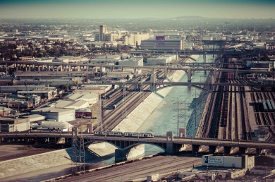
The Rosalinde and Arthur Gilbert Foundation has a awarded a grant of approximately $80,000 to the Luskin Center to develop a “how-to” manual for community-driven greenway projects along the Los Angeles River. Recognizing the vast untapped potential for accessible active transportation and healthy recreational opportunities along the River, and several decades of progress already made by community-based non-profits and local government in the northern part of the River, the Luskin Center set out to compile, analyze and repackage decades of institutional wisdom into an accessible and application-oriented guide called a “toolkit.” This toolkit will present step-by-step instructions for community leaders interested in developing: 1) a multi-modal linear pathway along the Los Angeles River, 2) a River-adjacent green open space, 3) a neighborhood access point or 4) a multi-modal bridge to improve access across the River.

Despite several decades of grass-roots and local government attention to the Los Angeles River, communities still lack the resources and tools that they need to engage directly with the River revitalization process. The Los Angeles River Greenway Toolkit project fills a vital gap with an accessible and well-researched guide designed to support river-adjacent communities. Henry McCann is the project manager and is working with graduate student researchers Andrew Pasillas and Shafaq Choudry, in addition to collaborating with a myriad of community organizations.

Recent Posts

  • Turner on Alternatives to School Police February 6, 2023
  • Latest Cohort of 4 Activists-in-Residence Is Largest Ever February 3, 2023
  • Kaplan on Challenges in Implementing Gun Control February 3, 2023
  • In Reparations Debate, UCLA Students Help Amplify Black Californians’ Voices February 2, 2023
  • Understanding the Epidemic of Mass Attacks January 31, 2023

Contact

UCLA Luskin School of Public Affairs

3250 Public Affairs Building - Box 951656
Los Angeles, CA 90095-1656

Campus Resources

  • Maps, Directions, Parking
  • Directory
  • Contact
  • Academic Calendar
  • Careers
  • Diversity
  • University of California
  • Terms of Use

Follow

The statements on this page represent the views of people affiliated with the Luskin School of Public Affairs and do not necessarily represent the views of the University of California, or UCLA or its Chancellor.
  • About
    ▼
    • Our Dean
    • Board of Advisors
    • Open Positions
    • Contact Us
    • Visit Us
    • Diversity, Disparities and Difference
    • Communications
      ▼
      • UCLA Luskin in the News
      • Luskin Forum Online
  • Departments | BA in Public Affairs
    ▼
    • Public Policy
    • Social Welfare
    • Undergraduate Program
  • Apply
    ▼
    • Master of Public Policy
    • Master of Social Welfare
    • Master of Urban and Regional Planning
      ▼
      • Double Degree With Sciences Po
    • PhD in Social Welfare
    • PhD in Urban Planning
    • Undergraduate Programs
  • Faculty
    ▼
    • Public Policy
    • Social Welfare
    • Urban Planning
  • Student Affairs & Alumni
    ▼
    • Career Services
    • Student Support
    • Graduate Resource Library
    • Alumni Relations
  • Support
  • Programs
    ▼
    • Research Centers & Affiliated Research
    • CalSWEC Public Child Welfare Program
    • Global Public Affairs (GPA)
    • Data Analytics Certificate
    • Luskin Lecture Series
    • Luskin Summit
    • Social Welfare at 75
  • Administration
    ▼
    • Graduate Resource Library
    • Academic Personnel
    • Financial Services
    • Emergency Safety
    • Events Office
      ▼
      • Events Calendar
      • Reserve a Room
    • Human Resources
    • For New Staff and Faculty
    • Information Technology
Scroll to top